


 244 / 540

243
go, but it is not clear what part was Antonel-
li’s contribution and which parts were the
remainder of the batteries and defensive sys-
tems created during more recent eras while
capitalizing on the perimeter described by the
Italian engineer.
The walled girdle protected the city to
the northwest from the interior of the island,
to the east from the river, and to the south
from attacks by sea using the natural rocky
wall where it was present. The oldest military
structure erected by the Europeans and still
visible in the Dominican Republic dates to the
first decade of the sixteenth century, and this
is the Ozama Fortress. The structure built at
the mouth of the river to defend the southeast
entry of the Colonial City was constructed
upon the orders of the Spanish governor Frey
Nicolás de Ovando. Although it has under-
gone changes and expansions over the centuries due to its different uses, the fortress has maintained its medi-
eval features. In 1990, it became a World Heritage Site along with the monuments from the historic Colonial
City of Santo Domingo. The complex is situated at an elevated location, separated from the river by a stone
wall, and is called the
Torre del Homenaje,
or The Tower of Homage. This is due to the fact that the boats arriv-
ing to the port were greeted from atop its 18 meters. The crenellated structure has thick coralline limestone
walls with loopholes: in the upper segment, it opens onto a walled garden that separates it from the urban
area, which is accessed by passing through the Puerta Carlos III gate built in 1797. Meanwhile, to the right of
the tower, the lower battery was defended from above by the cannon posts, and it is currently invisible from
the river. In the 1950s, in the style of the times, the complex was even further enclosed by a concrete fortifica-
tion, separating it from the Ozama River. Used as a prison until the end of the 1960s, the fortified complex was
opened to the public in 1965, due to its relevance as a monument of medieval architecture.
Following the course of the river from the fort, sections of walls and bulwarks from the original Colonial
City can be seen, which also continue along the south side along the coast. These portions cannot be dated
with accuracy, and it is possible to imagine only some of the changes with regard to location and reconstruc-
tion that were made over the centuries.
When Antonelli and Tejeda arrived in 1589, Santo Domingo had already lost some of its political and
commercial relevance to new ports in the Pacific, thus rendering irrelevant the large network of walls built in
anticipation of a fast pace of urban growth that nevertheless had already ceased during the first decades of the
sixteenth century. Antonelli overhauled the girdle of walls, bringing it closer to the city and adding bulwarks
along its entire length. Near the San Gil fortress, the outline of the girdle curves toward the north, extending
in alternate stretches. Among these, the Puerta de la Misericordia
gate and the Fuerte de la Concepción
fort
still remain, along with traces of the walls that once connected them, which can be seen from the road. The
fort faces toward the east, along the current Calle Juan Isidro Pérez, where the girdle again appears near the La
Caridad Fort ruins. A carefully planned residential design during the 1980s allowed for keeping the lower part
of the walls between the La Caridad and San Miguel
intact. This is a fortified area at ground level in the shape
of a pentagon, which has become a modern-day sports area for public use.
Following yet another interruption, the fortification again appears at the Hermitage of San Antón, with
the eponymous bulwark and a reconstruction of the walls that extends to the Santa Bárbara Cathedral. The
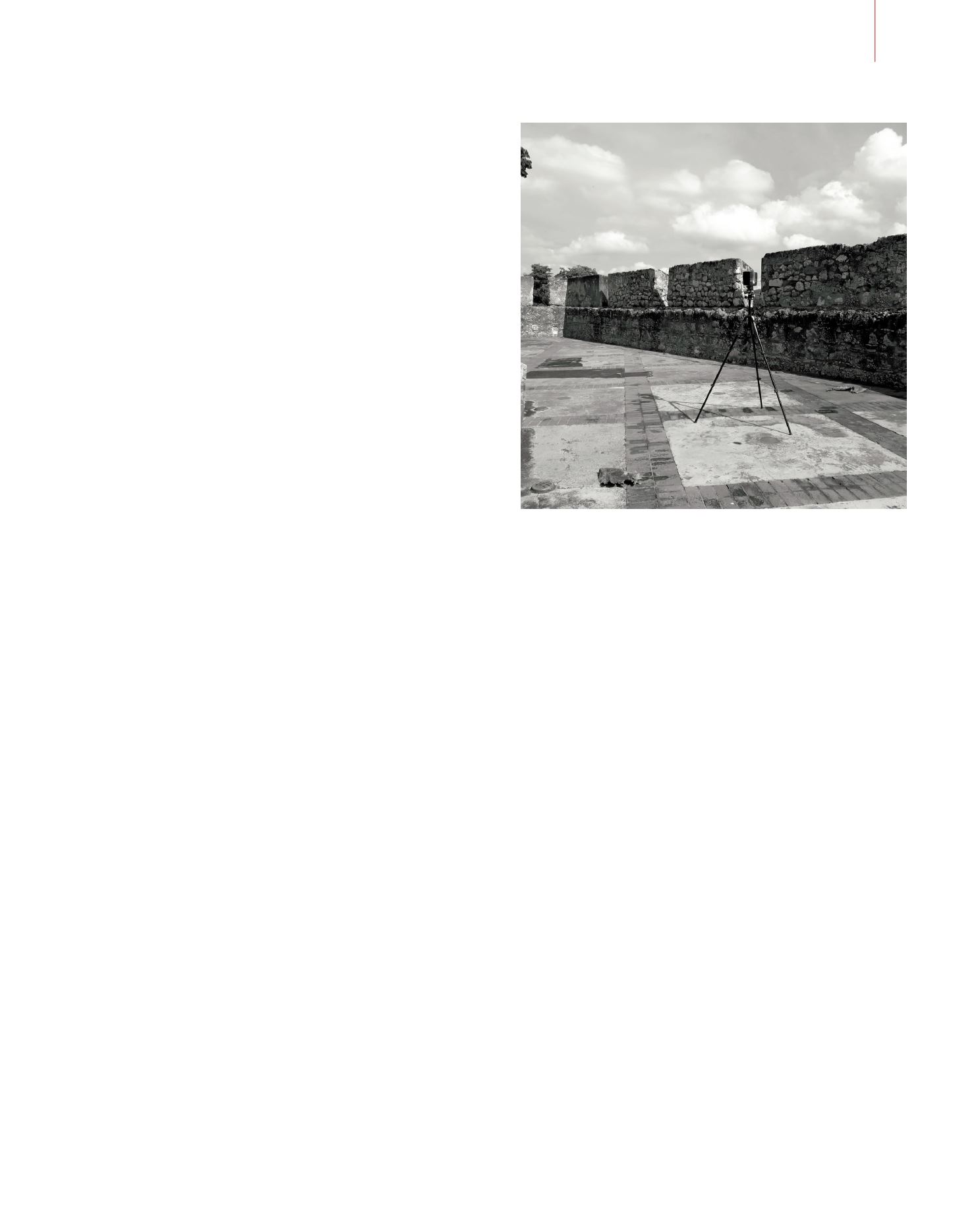
Image of the Bulwark
of the Invincible during
the documentation
activity carried out by
means of laser scanner
technology. The
Bulwark, located at the
point where the course
of the river narrows,
is one of the most
important in all of the
fortified perimeter
and probably one
of the portions of
the defensive girdle
depending directly on
Antonelli’s plan.
© Sandro Parrinello
THE WALLS OF SANTO DOMINGO AND DOCUMENTATION OF THE CONSTRUCTION PROJECTS BY THE ANTONELLI FAMILY